


From street and forestry mapping to waste transparency, Scotland is a hive of innovative businesses in the location data sector
December 2021
Location Data is being used in all aspects of our lives; from street mapping to advertising. There are some interesting solutions, utilising location data as an enabler of innovation being created in Scotland – the home of innovation.
We recently spoke with three of these businesses to find out what impact their innovative solutions are having on the wider marketplace.
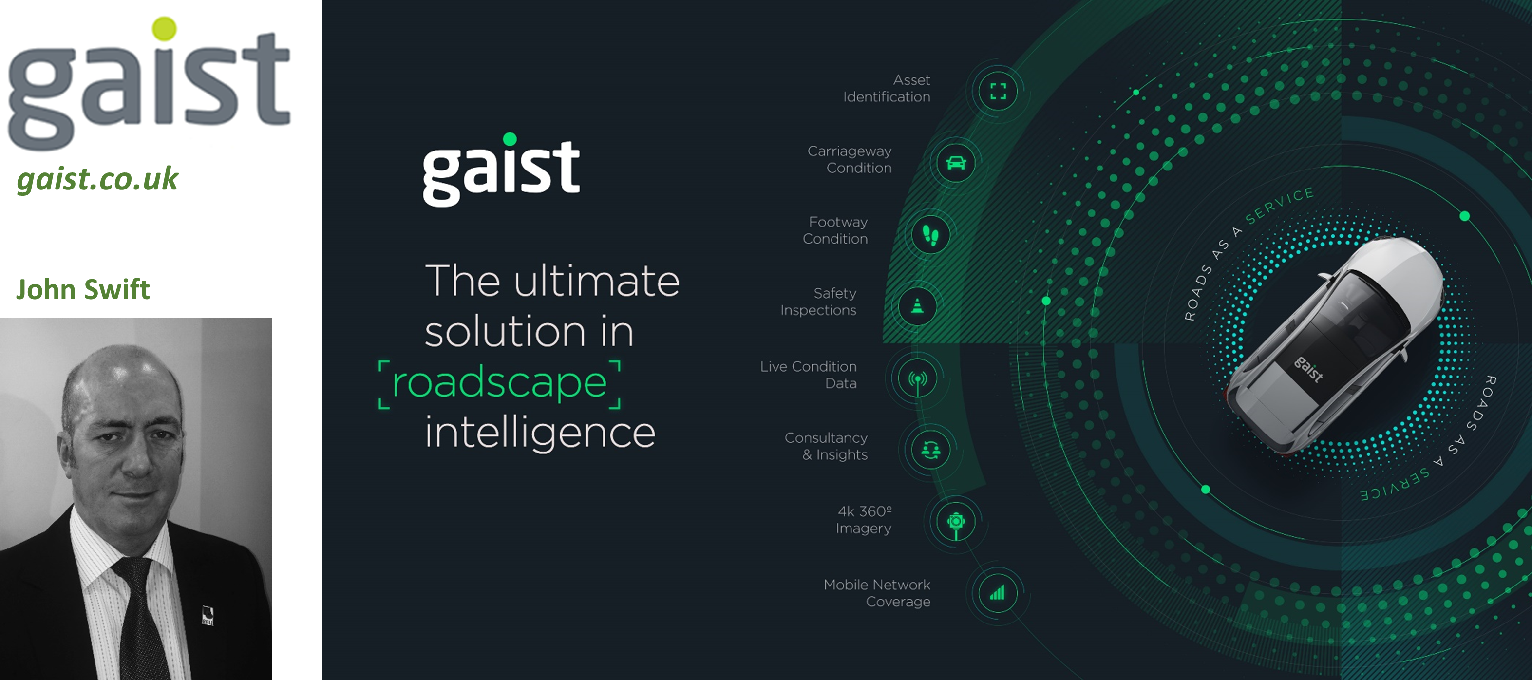
How does Gaist use location data?
Gaist works with local authorities, utilities and telecoms companies, utilising the most advanced location data and technology to better understand the condition of highway infrastructure and assets, enabling detailed lifecycle planning across the whole network to be undertaken.
What makes Gaist innovative?
Gaist collects 360° 4k roadscape imagery encompassing every road, footpath and asset (lighting columns, signage, bollards etc) across the UK. Their technology enables customers to identify where the issues on their network are and manage their highways maintenance activity with a degree of effectiveness never seen before.
Future plans
Through integration of dynamic condition data from vehicles circulating on the road network, Gaist can provide further modelling to highlight the prevalence and impact of poor road surfaces across whole networks. This presents a significant opportunity for local authorities to prioritise repairs and proactive maintenance on active travel routes. John Swift, Gaist Head of Business Development in Scotland, said, “The amount of location data we are collecting is highly significant for the Scottish local authority market and the focus for Gaist is to turn this big data into big value for our clients, enabling them to maximise resources and gain a better understanding of their full network over long periods of time.”
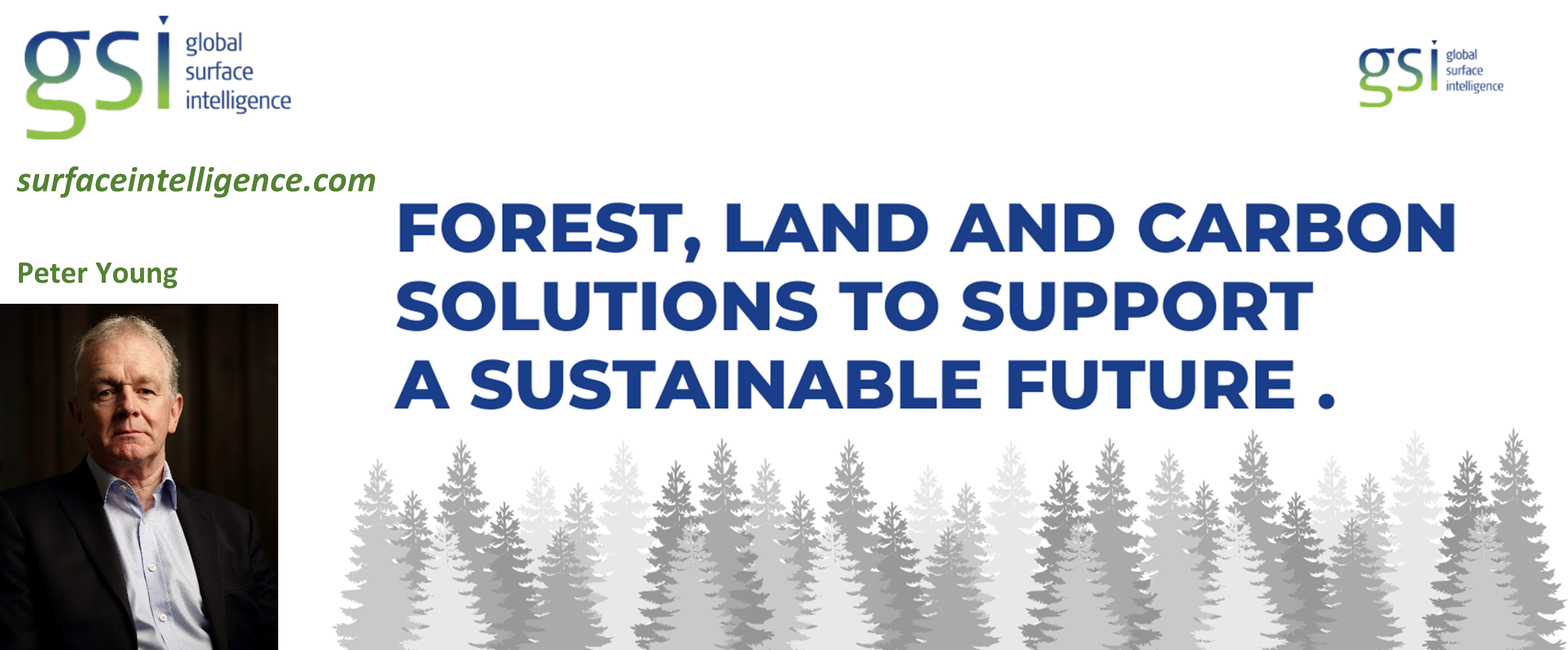
How does Global Surface Intelligence use location data?
GSI uses satellite imagery to produce analysis ready data to support due diligence forest owners, assets managers and real estate agents who need to have accurate and verifiable forestry assets. GSI combines the satellite data with LiDAR and ground survey reference data to produce large scale accurate forest inventories.
What makes Global Surface Intelligence innovative?
By producing analysis ready data GIS can measure, map and monitor forestry, land use and cover. Landowners, investors and service providers can make better informed decisions about their assets to enable management of natural resources significantly contributing to a more sustainable future.
Future plans
There is a major opportunity to leverage the GIS technology and platform to understand and verify forest carbon to…
- Discover unrealised carbon offset opportunities
- Quantify carbon stock
- Carbon credit aggregation
- Monitor carbon and conservation protocol compliance
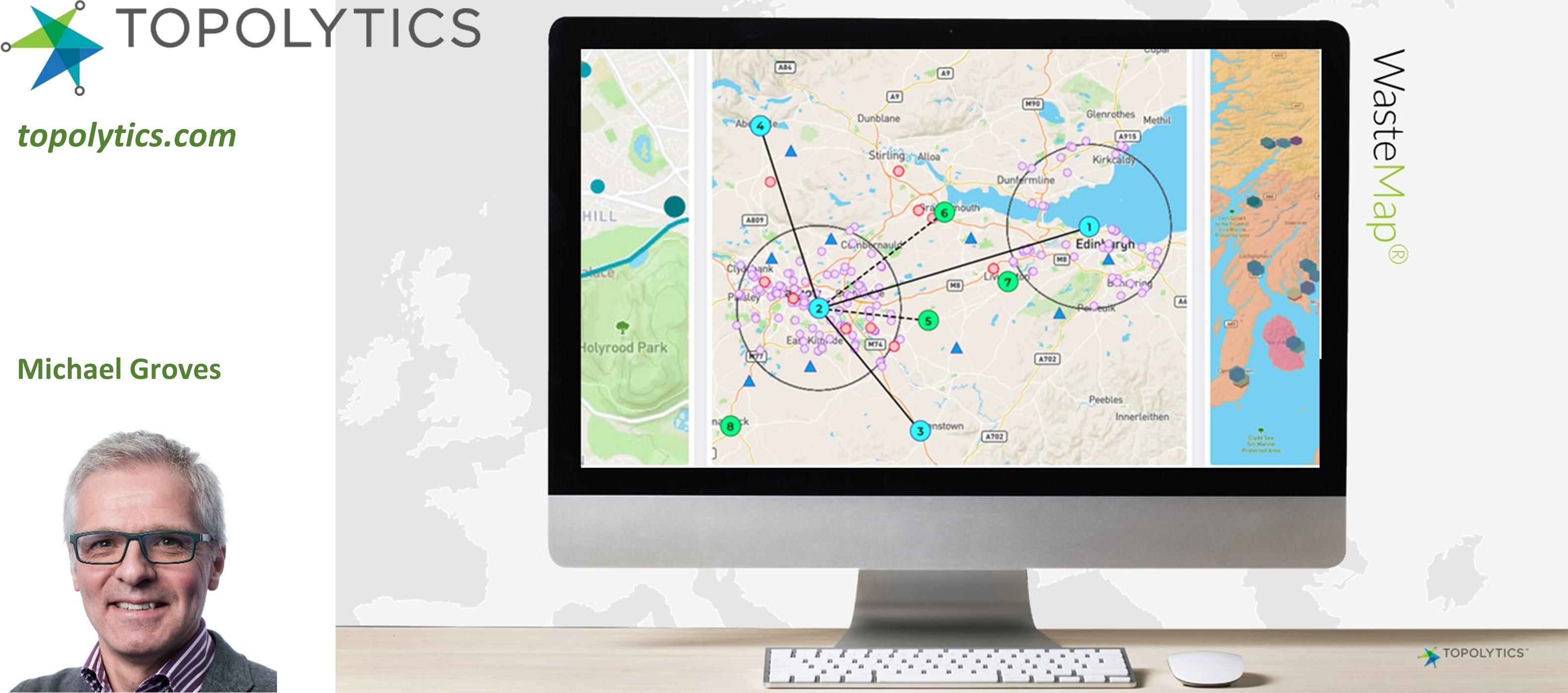
How does Topolytics use location data?
More than 60% of the world’s waste ends its life in a landfill, waste dump or leaks into the environment. The lack of transparency and trust across the waste system hampers resource recovery and value maximisation across the supply chain, that includes waste producers, the recycling industry and government.
Topolytics is a data aggregation and analytics business that is making the world’s waste visible, verifiable and valuable. Its WasteMap platform generates insights for waste producers, recyclers and government, that enable greater materials recovery, drive operational efficiencies, support investment strategies, enhance transparency and reduce carbon emissions through the WasteChain. Topolytics is acknowledged by IDC, Frost & Sullivan, Cleantech Group and SAP as a leading AI and analytics player in the $4.5Bn smart waste management sector.
What makes Topolytics innovative?
Companies are spending a considerable amount of money on managing waste, but have limited visibility and control over this material once it enters the waste and recycling supply chain. These companies are also setting corporate targets on NetZero and are subject to greater scrutiny on environmental, social and governance (ESG) performance. Through a subscription to WasteMap they get a live view on waste types and amounts and can see what happens to waste and by-products. The resulting insights support target setting and generate resource and cost savings as well as reducing carbon impacts.
Recyclers and waste brokers also have complex supply bases and are under growing scrutiny on what they do to waste material. WasteMap is enabling them to clean and manage many complex data sets and drive efficiencies, compliance and reporting.
Future plans
Topolytics has launched WasteMap as a subscription product to waste producers, recyclers and brokers. The company is growing its customer base in the UK and internationally and will be launching new modules in 2022 and beyond.
If your organisation is working with location data in an innovative way, please add your profile to the Location Data Scotland Directory. We welcome organisations from industry, academia, 3rd sector, government agencies and projects. Here you will be able to:
- Find Customers
- Find Suppliers
- Collaborate with new Partners
- Find out about Funding Sources and Partners
Directory


Developing a decarbonised transport agenda for a sustainable future
November 2021
Decarbonising the transport network is a huge challenge!
We recently partnered with Scottish Space and University of Edinburgh as part of KTN Space and Geospatial Virtual Pavilion at #COP26 and brought together a wealth of speakers from across the space and geospatial communities to explore the future of transport.
Common themes that came through were:
- Collaboration
- Standardisation and Interoperability
- Working together to create future roadmaps
- Open data sharing
Dr Hina Khan from Spire Global opened the event and shared her insights into how industry is generating and using lots of satellite data but we need to consider how we use this better to improve our environmental footprint and make our transport networks more robust and greener. To enable this we need better connectivity, especially across rural communities and less developed countries. We also need to make our networks smarter by supplementing them with machine learning and artificial intelligence tools and plugging the gaps in our knowledge and systems. We can significantly improve our infrastructure by tracking geospatial data from satellites to monitor critical infrastructure and support innovation in transport. Satellites – and the data they generate – is growing exponentially. Space data can support decision making but can’t solve all our problems.
The airline industry is a great example of where significant change is happening. Modern airlines are collating lots of geospatial and satellite data to track safety, logistics and passenger experiences to manage their aims to create greener and more economical processes. Consequentially decisions are being made to no longer use larger aircraft such as the A380 and replacing this aircraft with greener and more efficient aircraft.
One of the biggest challenges facing the industry is around standardisation. There is a desire and a defined need for transportation and environmental agencies to work together and create a common set of standards and uniformed processes so we can understand how we create consistency and ultimately become cleaner and greener. This data needs to be made open and accessible to all and used wisely to make the right choices.
Collaboration between the University of Edinburgh and Telespazio has resulted in some fantastic research and solutions being developed for transport networks utilising satellite data to monitor wide areas to enable data led decision making in areas such as tracking potential hazards in infrastructure movements and land-sliding. AIS and data from space is being used extensively across the maritime sector to track shipping behaviour, oil spills and maritime emissions. GIS is being used to model scenarios for transport planning and enable the construction sector to create infrastructure that addresses climate emergency across the full planning lifecycle.
There is a strong focus on reducing our carbon emissions and making us all better citizens. We need to utilise the data that is current and rich to understand where we are currently and predict what we will need in the future across all of society.
So, how we tackle transport poverty? Electric vehicles are not the only answer. We need to offer more choice and variety of transport options that are open and accessible to all. Electric vehicles are only open to people who can afford them. As an industry we need data and social scientists to work together to create public transport and electric options that work for everyone, designed around the concept of ‘mobility as a service’. There is also a massive opportunity for industry to create and support an open accessibility map utilising geospatial data to indicate where there are dropped curbs, disabled toilets, disabled friendly restaurants and shops etc.
If we want to develop a connected transport infrastructure there needs to be open sharing of data, providing options for more low carbon emission options and more access. As an industry, transport, energy and data experts need to come together and find solutions to make our world more sustainable. For Government agencies planning new cities – how do they plan the future of transport? There are big challenges around moving goods around the country and how to deliver this on a carbon neutral basis, adhering to our desire to have things delivered ‘next day’.
To achieve our objective of a decarbonising agenda for the future of transport, there are some key steps we need to take:
- Collaboration across departments, organisations and sectors can really make great things happen! There is a massive opportunity to bring communities and innovators together
- To work together as a nation to put roadmaps in place to address challenges
- Access to more geospatial and GPS data
- Create standardisation and strategies for interoperability
If you are working in the space, transport, location data or geospatial sector, why not join our Directory and put your organisation on the map!
DIRECTORY

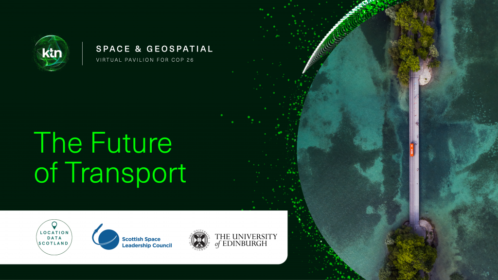
The Future of Transport at COP26
November 2021
Geospatial intelligence is critical to solving the climate change challenge.
To influence changes at a global level, we need to understand the impact of climate change at a local level. The availability of geospatial data at scale is unlocking new ways to provide meaningful insights into complex global climate science that can be applied to virtually any sector of the economy.
As COP26 transcends in Glasgow this week Location Data Scotland in partnership with Space Scotland (Scottish Space Leadership Council) are delivering a virtual event at KTN’s Space and Geospatial Virtual Pavilion for COP26 on Wednesday 10th November exploring The Future of Transport.
This webinar will consider how space and geospatial fits into the wider transport and mobility landscape and how various transport improvements are leading towards net zero targets. Exemplars of how space and geospatial data is being used to create transport efficiencies will be shared followed by a discussion on lessons that can be drawn from these use cases to inform the future of transport.
We will be joined by industry experts including our keynote Dr Hina Khan, Project Coordinator at the highly innovative Spire Global, and John Innes, CTO & VP Technology Innovation, Innovation & Technology Group of global leader, Leonardo.
Agenda
Wednesday 10th November
| 12:30-12:35 | Introduction | Speakers:
|
| 12:35-12:45 | Keynote: How space data links with transport | Dr Hina Khan, Project Coordinator, Spire Global |
| 12:45-12:55 | What is transport? | Hayden Sutherland, Founder & Chair, Open Transport Initiative |
| 12:55-13:00 | Q and A | |
| 13:00-13:25 | Panel 1: Exemplars of space & geospatial in transport | Chair:
Panel guests:
|
| 13:25-13:50 | Panel 2: Future of Transport | Chair:
Panel guests:
|
| 13:50-14:00 | Closing remarks | John Innes, CTO & VP Technology Innovation, Innovation & Technology Group, Leonardo |
Further information about KTN’s Space and Geospatial Virtual Pavilion for COP26 can be found here.
REGISTER


Geospatial Demystified
October 2021
As a term, geospatial is still relatively unknown. Perhaps terms like location data or location intelligence are more helpful? But beyond terminology, describing geospatial provides understanding of its huge potential.
Abigail Page, Head of Innovation and Skills at the Geospatial Commission describes what is meant by the ‘buzz word’ geospatial and where it is having impact in our everyday lives.
Firstly, geospatial data is a representation of the world around us in a digital form. That is the ability to represent those through data which can be captured in many different ways – from ground surveys, to images from space or sensors tracking our journeys. Bringing different sources and information together and being able to visualise it by its location enables us to understand and model it in new ways.
Secondly, being able to apply geospatial technology and data can enable integration and interrogation of information to create an understanding that is valuable for society. Tobler’s first law of geography states that “”everything is related to everything else, but near things are more related than distant things.” Understanding location is fundamental to being able to identify relationships and patterns in many types of data.
What inspires me most about geospatial is its ability to be deployed and have impact from local to global levels. For example, at an individual level ensuring my takeaway turns up or reminding me where I parked the car. For neighbourhoods forming the basis of local public services, such as city planning, school catchments or refuse collections. And at a global level addressing the most challenging of global issues, such as the recovery from a global pandemic or achieving net zero emissions.
I’m proud to have been part of developing the UK Geospatial Strategy, which sets out how we can unlock the value of location data, outlining nine key opportunity areas alongside helping to shape the Location Data Scotland programme. Geospatial Commission initiatives, such as the £5 million Transport Location Data Competition, are connecting geospatial innovators with public sector partners to fund new transport solutions and the National Underground Asset Programme will improve the way that national infrastructure is planned, built and managed.
In Scotland there is a vibrant geospatial community but also many opportunities and challenges where geospatial can be applied. Through Location Data Scotland there is a real opportunity to demystify geospatial and reach beyond specialists. It is time to move beyond worrying about terminology, and work to unlock value through innovation and partnerships.

DDK Positioning’s journey from idea to commercialisation
October 2021
Our recent event ‘Where’s the Value in Location Data’ told the journey of DDK Positioning, an Aberdeen based organisation who provide GNSS Precise Point Positioning Services globally to make position more accurate.
Simon Canning, Operations Director at DDK Positioning shared his insights at the event, highlighting how they developed the idea, secured several rounds of funding, built the solution and selected their route to market using Value Added Resellers as that provided them with a global sales team of around 1000 individuals and gave access to an already significant ecosystem of customers.
Simon also provided 3 key lessons learned from their journey so far:
- It’s important to strike a balance. Your product doesn’t have to be 100% perfect before it is released, so strike a balance between the minimum viable product and polishing the diamond!
- Stay Focused. Don’t get distracted by other opportunities that will take the business focus away from the key products/markets you want to focus on.
- Make sure you leave a realistic amount of time for each stage in the process and build this into your development/delivery time
If you missed this event, catch up on Simon’s presentation on YouTube here.
We also had a really engaging networking session as part of the event. Anne Robertson, Head of Services and User Engagement, EDINA, The University of Edinburgh commented,
“Location Data Scotland’s recent event had a dedicated networking session where attendees had the opportunity to meet other individuals at the event in break-out rooms. This was a great opportunity to find out about what others in the sector are doing and to hear about some of the really interesting, innovative products and services utilising and/or generating location data. With the return of physical events still unsure, it is important to have virtual networking events such as these to build communities and help organisations collaborate.”


Where is the Value in Location Data?
September 2021
The Location Intelligence Market Study, January 2019 highlighted the importance of real-time location data for different types of organisations. The report highlighted that 70% of telecommunications companies and 40% of public sector/local authorities consider location intelligence to be critical to their success.
Traditionally, location data enabled organisations to keep track of their materials, equipment and the employees working with that equipment. Now the availability of real-time location data significantly enhances operational efficiencies, improves project planning, ensures compliance where needed, and contributes to worker safety.
The widespread use of mobile applications and enhanced location sharing capabilities on mobile devices has revolutionised the way services are being delivered to end-users across multiple industries.
Companies, such as Google, Qualcomm, Intel, and Apple are making significant investments in location intelligence technologies across smartphones, vehicles, and aircraft. These tools enable them to collect a variety of information to enable better decision making and delivering better products and services. The need to improve cost efficiency and optimise business operations has increased demand for location intelligence tools across various industries, which is anticipated to accelerate market growth.
Location data opens up multiple opportunities, but the real question for organisations looking to utilise location data or commercialise the data they are collecting, is how to monetise it. Scotland’s location data ecosystem is growing, and a number of organisations are already starting to build robust commercially-aligned business models. You can view some of these on our website here.
One company who is doing just that is Aberdeen based DDK Positioning. They have created a robust, resilient and completely independent GNSS Precise Point Positioning (PPP) solution that can be used across a wide range of sectors including offshore survey & construction, marine, agriculture, renewables, automotive, aviation and IoT.
Our next event ‘Where is the Value in Location Data?’ will feature Simon Canning, Operations Director of DDK Positioning who will explain how they have taken their innovative concept and monetised it, working with customers and partners in various sectors.
To hear how Simon monetised their solution, Register Here