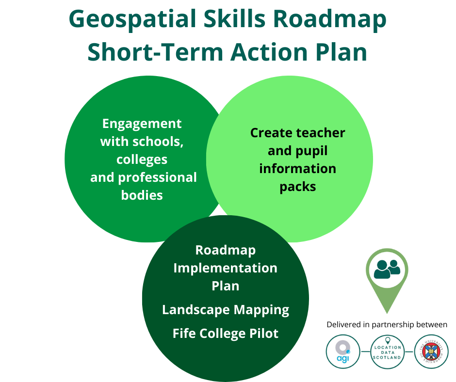
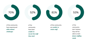
Developing the skills agenda for the geospatial sector in Scotland is critical to ensuring a pipeline of skilled talent is available to expand the economy and grow the sector. Scotland is currently limited to courses at MSc level; thus, impacting the breadth and diversity of individuals training and coming into the sector.
By bringing together leaders from industry, and academia LDS, in partnership with University of Edinburgh and AGI Scotland, has been working over the last 2 years to identify the skills gaps in geospatial across Scotland and has created a unified skills roadmap for the future. Our ambition is to create more jobs using geospatial skills and make Scottish talent more marketable to industry, attracting more companies to set up in Scotland as there will be a cluster of skilled talent, and a dedicated pipeline of highly skilled personnel to support emerging industry requirements. The work on developing the skills roadmap has resulted in a first-of-its-kind pilot programme being initiated with Fife College to develop and test a dedicated geospatial skills course as an introduction into the Geospatial industry.
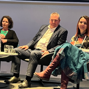
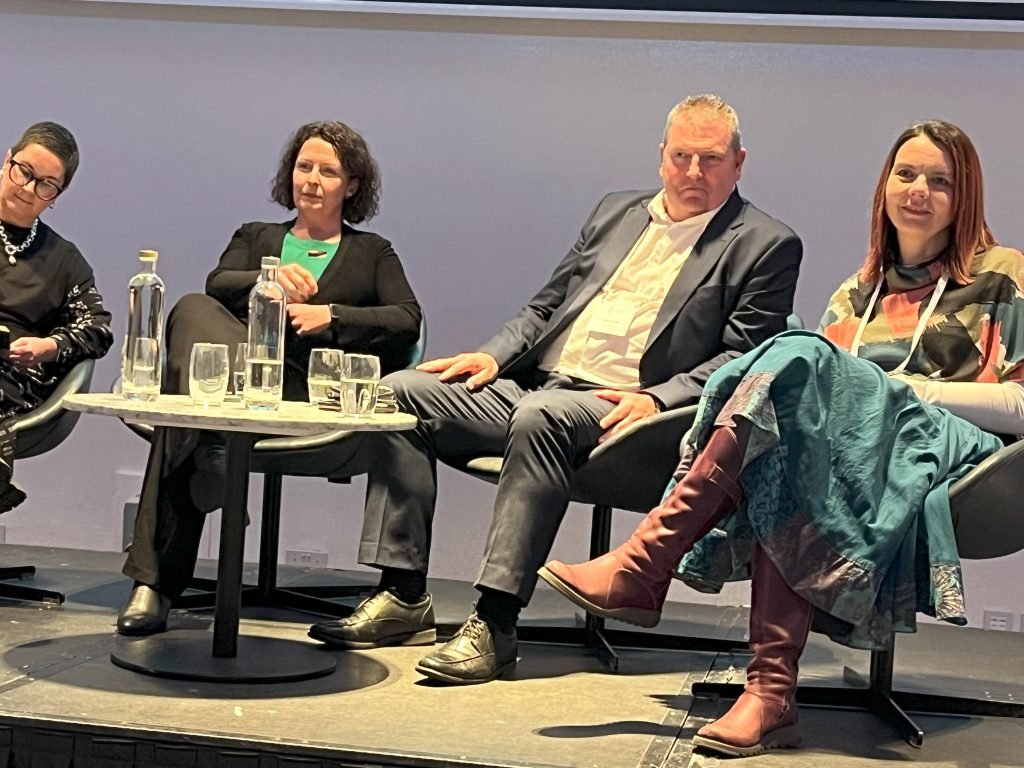
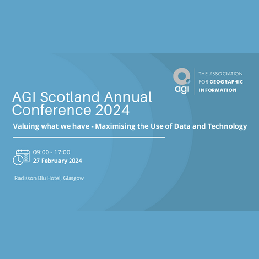
We are delighted to be hosting a panel at the AGI Scotland conference on 27th February 2024 in Glasgow, bringing together key individuals from across the sector to build on the work already done and explore where we go from here.

Alan Corbett, Head of Geospatial at The Scottish Government
Alan heads up the Scottish Government’s Geographic Information Science and Analysis Team (GI-SAT) within the Digital Directorate. Alan has worked in the Scottish Government’s Geographic Information Service (then SEGIS) since 1998 when the geographic information was first introduced within Government. He has been instrumental in promoting the use of GIS within Government and the Scottish Public sector and is delighted to see how GIS mapping and analysis has developed into an integral part of the decision making process for policy directorates and senior Ministers within the Scottish Government.
Alan’s primary responsibility is giving advice to both internal and external stakeholder on how GI data, systems and analytical processes support strategic decision making across all Scottish Government Directorates and its partner organisations with projects such as the National Resilience and recently the Government Covid Response. He is also responsible for substantive projects or initiatives within the Scottish Government such as the collaboration and procurement of geospatial data for the Scottish Public Sector. Leading on the Public Sector Geospatial Agreement (PSGA) for Scotland, Alan’s role is to ensure it delivers strategic direction, robust timely data and value for money to support all Scottish Public Sector organisations in the delivery of their statutory requirements.
Jenni Doonan, Head of Projects, Faculty of Engineering & Technology, Fife College
Jenni had a 15 year career working in engineering in the European Space Industry before moving into education. She has spent time working at the University of Edinburgh on the Data Education for Schools project as part of the Edinburgh and South East Scotland City Deal before moving to Fife College as Head of Projects in the Faculty of Engineering & Technology. She is responsible for developing innovation projects which give the college the capability and capacity to provide education in new and emerging skills areas.
Nikki Smith, Senior Digital Specialist, British Geological Survey
Nikki is a Senior Digital Specialist within the International division of BGS and has a focus on the design, development and implementation of custom spatial data capture and delivery systems, as well as the design and implementation of digital workflows. Nikki also works extensively with international geological surveys as they aim to increase the use and delivery of their geospatial data, and her work has taken her from Europe to Africa to Central and SE Asia. In addition, Nikki is the Vice-Chair for the Association for Geographic Information – Scotland committee.
Ashley Stewart, Senior Consultant for Optimat and Lead for Location Data Scotland
Ashley co-ordinates and manages Location Data Scotland, on behalf of Scottish Government, to transform services and create new products using geospatial technologies and/or location data in Scotland.
She specialises in data, digital and emerging technologies. Ashley is experienced in techno-market/demand analysis, technology roadmap development, strategy and commercialisation support to private and public sector organisations. Ashely has a BA (hons) Marketing, an MSc IT with Web Development and a PhD in Technology Enhanced Learning and Communities of Practice.


 There have been giant leaps in how the emergency services sector in Scotland is using geospatial data to drive efficiencies and provide the public and business with access to key public services. Scotland has one of the most successful Covid vaccine rollout programmes and location data was at the core of how the health service delivered this highly efficient programme.