Menu Close

LDS opening the right doors for B2B solutions provider Vahanomy

LDS opening the right doors for B2B solutions provider Vahanomy

Tech entrepreneur Arun Gopinath has a vision of the future with a fully joined up inclusive ecosystem for autonomous vehicles and services and is positioning his company Vahanomy at the heart of that ecosystem.

The global EV charging public infrastructure market is forecast to be US$60 billion by 2030, with location analysis and site selection estimated at 8% of the cost (US$4.8 billion). Early this year the UK government announced that they were allocating £450m to create 300,000 public charging stations, a huge opportunity for Vahanomy. Arun comments:

“We don’t know exactly what the autonomous vehicle landscape will look like in the future but what we do know is that it will be powered by electric vehicles in the foreseeable future. There is currently a huge opportunity in Scotland and the rest of the UK to lay the foundations for our future vision and we see a massive opportunity to introduce our services to the rest of the world.”

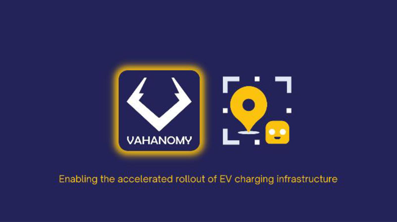
Vahanomy is an Edinburgh based start-up developing innovative artificial intelligence data drivenB2B solutions to enable the accelerated rollout of electric vehicles (EV) charging infrastructure globally.

The company’s first two products include an AI-powered location data intelligence tool that will assess and analyse proposed EV charging locations and the portal; a B2B and B2C marketplace listing potential charging sites and services and facilitate the trading of EV charging sites and trading capacity and provide analytics of demand and supply of services in the EV charging ecosystem.


As a business, Vahanomy has a strong ethical stance that they will create solutions for everyone that will reduce our carbon footprint and make transport much more mobile and accessible.Arun and his fellow directors originate from outside Scotland and were challenged when starting to build their network of connections in Scotland. Arun commented:

“There is a fantastic support network across Scotland from Scottish Enterprise, to the University infrastructure, with lots of different touch points to find partners, investors, customers, and staff. Unfortunately, if you are not originally from Scotland and not part of a university network it is difficult to know how to start navigating this landscape. Vahanomy was accepted onto the TravelTech for Scotland programme which then exposed them to Location Data Scotland and the EIE (Engage, Invest, Exploit) programme through the University of Edinburgh. Each of these connections have provided lots of different opportunities and validation.”

Vahanomy identified several key stakeholders that they wanted to engage with through Location Data Scotland to help them quantify their idea, test their technology and source data sets including Registers of Scotland, the Improvement Service, Geospatial Commission and Ordnance Survey. Arun commented:

“We realised early on that these stakeholders were going to be instrumental in helping ussource the data we needed to deliver our services and evolve our ecosystem. Ashley at Location Data Scotland has a fantastic network of connections and she easily started opening doors for us to the right people across the location data domain. We’ve had initial meetings with these individuals, and they have started to share information and open doors that have been instrumental for the next stages in our business growth.”

To find out more about Vahanomy visit www.vahanomy.com

Developing a decarbonised transport agenda for a sustainable future

city traffic at night

Developing a decarbonised transport agenda for a sustainable future

November 2021
Decarbonising the transport network is a huge challenge!

We recently partnered with Scottish Space and University of Edinburgh as part of KTN Space and Geospatial Virtual Pavilion at #COP26 and brought together a wealth of speakers from across the space and geospatial communities to explore the future of transport.

KTN Space and Geospatial Virtual Pavilion for COP26

Common themes that came through were:

  • Collaboration
  • Standardisation and Interoperability
  • Working together to create future roadmaps
  • Open data sharing

Dr Hina Khan from Spire Global opened the event and shared her insights into how industry is generating and using lots of satellite data but we need to consider how we use this better to improve our environmental footprint and make our transport networks more robust and greener.  To enable this we need better connectivity, especially across rural communities and less developed countries.  We also need to make our networks smarter by supplementing them with machine learning and artificial intelligence tools and plugging the gaps in our knowledge and systems.  We can significantly improve our infrastructure by tracking geospatial data from satellites to monitor critical infrastructure and support innovation in transport.   Satellites – and the data they generate – is growing exponentially.  Space data can support decision making but can’t solve all our problems.

The airline industry is a great example of where significant change is happening. Modern airlines are collating lots of geospatial and satellite data to track safety, logistics and passenger experiences to manage their aims to create greener and more economical processes.  Consequentially decisions are being made to no longer use larger aircraft such as the A380 and replacing this aircraft with greener and more efficient aircraft.

One of the biggest challenges facing the industry is around standardisation.  There is a desire and a defined need for transportation and environmental agencies to work together and create a common set of standards and uniformed processes so we can understand how we create consistency and ultimately become cleaner and greener.  This data needs to be made open and accessible to all and used wisely to make the right choices.

Collaboration between the University of Edinburgh and Telespazio has resulted in some fantastic research and solutions being developed for transport networks utilising satellite data to monitor wide areas to enable data led decision making in areas such as tracking potential hazards in infrastructure movements and land-sliding.  AIS and data from space is being used extensively across the maritime sector to track shipping behaviour, oil spills and maritime emissions.  GIS is being used to model scenarios for transport planning and enable the construction sector to create infrastructure that addresses climate emergency across the full planning lifecycle.

There is a strong focus on reducing our carbon emissions and making us all better citizens.  We need to utilise the data that is current and rich to understand where we are currently and predict what we will need in the future across all of society.

So, how we tackle transport poverty?  Electric vehicles are not the only answer.  We need to offer more choice and variety of transport options that are open and accessible to all.  Electric vehicles are only open to people who can afford them.  As an industry we need data and social scientists to work together to create public transport and electric options that work for everyone, designed around the concept of ‘mobility as a service’.  There is also a massive opportunity for industry to create and support an open accessibility map utilising geospatial data to indicate where there are dropped curbs, disabled toilets, disabled friendly restaurants and shops etc.

If we want to develop a connected transport infrastructure there needs to be open sharing of data, providing options for more low carbon emission options and more access.  As an industry, transport, energy and data experts need to come together and find solutions to make our world more sustainable.  For Government agencies planning new cities – how do they plan the future of transport?  There are big challenges around moving goods around the country and how to deliver this on a carbon neutral basis, adhering to our desire to have things delivered ‘next day’.

To achieve our objective of a decarbonising agenda for the future of transport, there are some key steps we need to take:

  • Collaboration across departments, organisations and sectors can really make great things happen! There is a massive opportunity to bring communities and innovators together
  • To work together as a nation to put roadmaps in place to address challenges
  • Access to more geospatial and GPS data
  • Create standardisation and strategies for interoperability

If you are working in the space, transport, location data or geospatial sector, why not join our Directory and put your organisation on the map!

DIRECTORY

The Future of Transport at COP26

LDS SSLC EDI COP26 Session

The Future of Transport at COP26

November 2021
Geospatial intelligence is critical to solving the climate change challenge.

To influence changes at a global level, we need to understand the impact of climate change at a local level. The availability of geospatial data at scale is unlocking new ways to provide meaningful insights into complex global climate science that can be applied to virtually any sector of the economy.

As COP26 transcends in Glasgow this week Location Data Scotland in partnership with Space Scotland (Scottish Space Leadership Council) are delivering a virtual event at KTN’s Space and Geospatial Virtual Pavilion for COP26 on Wednesday 10th November exploring The Future of Transport.

This webinar will consider how space and geospatial fits into the wider transport and mobility landscape and how various transport improvements are leading towards net zero targets.  Exemplars of how space and geospatial data is being used to create transport efficiencies will be shared followed by a discussion on lessons that can be drawn from these use cases to inform the future of transport.

We will be joined by industry experts including our keynote Dr Hina Khan, Project Coordinator at the highly innovative Spire Global, and John Innes, CTO & VP Technology Innovation, Innovation & Technology Group of global leader, Leonardo.

Agenda

Wednesday 10th November

12:30-12:35 Introduction Speakers:

  • Kristina Tamane, University of Edinburgh
  • Ashley Stewart, Location Data Scotland
  • Daniel Smith, Astro Agency
12:35-12:45 Keynote: How space data links with transport  Dr Hina Khan, Project Coordinator, Spire Global 
12:45-12:55 What is transport? Hayden Sutherland, Founder & Chair, Open Transport Initiative
12:55-13:00 Q and A
13:00-13:25 Panel 1: Exemplars of space & geospatial in transport Chair:

  • Deborah Paton, Group Manager: Connectivity Plan, Glasgow City Council

Panel guests:

  • Geraint Cooksley, Head of Geo Information, Telespazio
  • Simon Mudd, Personal Chair in Earth Surface Processes
  • Katie Chesworth, Principal Transport Planner, Transport Unit Sustainability & Climate Change Lead, Mott MacDonald
  • Katherine Elsom, Head of Marketing, UK Intelligence, Connected Intelligence, Airbus Defence and Space
13:25-13:50 Panel 2: Future of Transport Chair:

  • Ken Gordon, ESA Ambassador

Panel guests:

  • Alejandro Gutierrez-Alcoba Research Fellow, University of Edinburgh
  • Tim Embley, Group Research & Innovation Director Costain
  • Dr Michelle Carter, Head of Transport, KTN
13:50-14:00 Closing remarks John Innes, CTO & VP Technology Innovation, Innovation & Technology Group, Leonardo

Further information about KTN’s Space and Geospatial Virtual Pavilion for COP26 can be found here.

REGISTER

Geospatial Demystified

Transport
Transport

Geospatial Demystified

October 2021
As a term, geospatial is still relatively unknown. Perhaps terms like location data or location intelligence are more helpful? But beyond terminology, describing geospatial provides understanding of its huge potential.

Abigail Page, Head of Innovation and Skills at the Geospatial Commission describes what is meant by the ‘buzz word’ geospatial and where it is having impact in our everyday lives.

Firstly, geospatial data is a representation of the world around us in a digital form. That is the ability to represent those through data which can be captured in many different ways – from ground surveys, to images from space or sensors tracking our journeys. Bringing different sources and information together and being able to visualise it by its location enables us to understand and model it in new ways.

Secondly, being able to apply geospatial technology and data can enable integration and interrogation of information to create an understanding that is valuable for society. Tobler’s first law of geography states that “”everything is related to everything else, but near things are more related than distant things.” Understanding location is fundamental to being able to identify relationships and patterns in many types of data.

What inspires me most about geospatial is its ability to be deployed and have impact from local to global levels. For example, at an individual level ensuring my takeaway turns up or reminding me where I parked the car. For neighbourhoods forming the basis of local public services, such as city planning, school catchments or refuse collections. And at a global level addressing the most challenging of global issues, such as the recovery from a global pandemic or achieving net zero emissions.

I’m proud to have been part of developing the UK Geospatial Strategy, which sets out how we can unlock the value of location data, outlining nine key opportunity areas alongside helping to shape the Location Data Scotland programme. Geospatial Commission initiatives, such as the £5 million Transport Location Data Competition, are connecting geospatial innovators with public sector partners to fund new transport solutions and the National Underground Asset Programme will improve the way that national infrastructure is planned, built and managed.

In Scotland there is a vibrant geospatial community but also many opportunities and challenges where geospatial can be applied. Through Location Data Scotland there is a real opportunity to demystify geospatial and reach beyond specialists. It is time to move beyond worrying about terminology, and work to unlock value through innovation and partnerships.