Shining the Light on Location Data in PropTech
The UK’s Geospatial Strategy 2020 – 2025 highlighted huge potential for location data in the construction industry to improve planning, build and management within national infrastructure, from informing where our future broadband and 5G networks need to go, to planning new housing developments. Analysis from 2018 suggests that more accessible and better quality location data in infrastructure and construction could be worth over £4 billion per year¹.
Geospatial technologies are a critical component of smart city operations, with precise mapping data being used before, during and after a construction project. Geospatial construction, or ‘geoconstruction’ uses data from a wide range of focal points such as location, population, and environment, to influence the design and construction of a building to save, time, money and reduce waste.
In fact, the construction and property industry in the UK is already testing new ideas as to how to best use these different types of data. For example, The London Borough of Waltham Forest has been exploring how location data could be used to help planners make better informed decisions. Having been awarded a grant, Waltham Forest has been looking into the potential for satellite imagery to help identify various stages of building construction, to help monitor the progress of housing developments. The borough is also testing the effects of earlier allocation of Unique Property Reference Numbers (UPRNs) to a development site, to help build and maintain a complete timeline of development.
LDS is co-delivering an event on 23rd June from 10:00 – 11:30 in partnership with Scottish Development International (SDI), European Space Agency (ESA), Enterprise Europe Network (EEN), CENSIS and Construction Scotland Innovation Centre (CSIC) that will shine a light on technological solutions and funding support designed for the property market that currently rely on Location Data to enhance the built environment. Register here.
Key industry experts will share their personal and organisational journeys, demonstrating their contribution to Scotland’s wider digital transformation, while highlighting technologies with the potential to disrupt standard practice.
Simeon Oxizidis, IES – at the forefront of the development and application of powerful software simulation tools and consulting services for architects, engineers and others involved in the design, development and management of truly sustainable buildings.
Gordon Mitchell, Key FM – one the longest established facilities management businesses in the UK.
Falk Bleyl, Utopi – a leading data integration and IoT platform for Real Estate – creating smart assets that are sustainable, efficient, and safe; they are creating the future of smart, sustainable buildings.
Simon Tricker, Urban Tide – Smart City Data Experts born from creating the UK’s first Future City and we are making a sustainable world with AI. They were formed in 2014 from the team that bid, planned & delivered Innovate UK’s £24M future cities demonstrator for Glasgow (futurecity.glasgow.gov.uk).
Location data, the power behind tourism technology
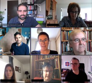
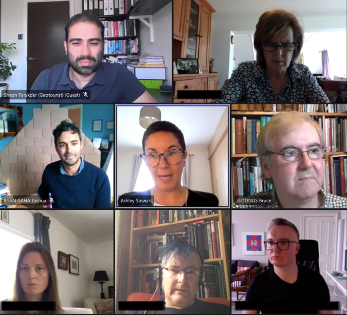
At the recent Location Data Scotland event in partnership with TravelTech for Scotland we explored the opportunities that location data opens up for the travel and tourism sector in Scotland.
Whether it is for transport, accommodation and food, visitor attractions, scenic locations or retail therapy, we all require location data to be able to source and visit these locations. Joshua Ryan-Saha at Traveltech for Scotland shared some excellent examples of traveltech and tourism businesses, many accessible in the Traveltech for Scotland Directory using location data to drive their businesses:
Whereverly allows visitors to enjoy local culture, songs and stories using their location
What3words is a much more accurate location data source than Google Maps
Electrek maps every electric vehicle point across Scotland
Flockeo provides a sustainable tourism approach for travellers
Walks and Waterfalls is a start-up business providing the ability to locate over 300 walks, waterfalls and wild swimming places in Scotland
Route making and navigation rely exclusively on location data for walking or bus tours or cycling trips. But to enable it there are some key things we, as a nation, require:
- Ubiquitous 4G data
- Location based services
- Connected services
Scotland is steeped in tourism resources and locations, however as a visitor or resident is it difficult to link them all together. The key element that links them is geography and location.
Bruce Gittings from the University of Edinburgh showed us the Gazetteer for Scotland – an interactive resource that provides a fantastic alternative to a guidebook, with 27,000 entries, 10,000 photographs and 5 million words of text. A dynamic map personalised for individuals it provides a goldmine of information for visitors to identify linked activities within a defined geographical location. It even offers the ability to trace historical connections to ancestors.
Real time location data tracking also plays an important role in travel tech. Huli is an app that creates cycling routes based on your location. Steve Owens from Huli described how real time geographical information is the underlying element of the Huli app which provides cyclists with the ability to create the best cycling route based on their preferences. When asked what the future holds for location data, Steve commented:
“I think the fusion of time with location data will present massive opportunities for travel tech and tourism businesses. This will allow the sector to present just-in-time information that is relevant to the user based on where they are and when they are there.”
Every town and location has a story to tell but as a storyteller how do you tell your stories for destinations and visitors? Shaon Talukder from Geotourist showed their very clever app that provides a personal tour guide for the world’s attractions and landmarks. Based on location, it provides auto-play guided audio tours in multiple languages on your phone. When asked what the future holds for location data, Shaon said:
“Some of the biggest opportunities in location data for travel tech and tourism businesses are from understanding what motivates people to go to places. Our focus at Geotourist, is to understand what stories, in the form of free shareable digital audio tours on our global user-generated content platform, inspire people to travel. At the same time, we are leveraging storytelling together with location guidance, to address big tourism challenges like overtourism where visitors are made aware of nearby alternatives to overcrowded spots.”
Tourism and traveltech businesses need location data to feed their platforms and apps, but the biggest challenge facing this rapidly growing sector is how they work together to find open data sources and share their own data with other like-minded businesses. Initiatives like Location Data Scotland can help. Ashley Stewart from Optimat said:
“This was a great event that highlighted how important location data is for the travel tech sector. There are some amazing businesses already providing some fantastic solutions to destination and tourism challenges and with the help of Location Data Scotland, we hope to open up even more opportunities.”
Be part of Scotland’s Location Data Directory
Does your organisation use or supply location data in innovative ways to solve problems, improve services, enhance skills and/or refine customer experience?
Any organisation in Scotland using or suppling location data in innovative ways can add their profile to our Directory and access a range of benefits:
- Find Customers
- Find Suppliers
- Collaborate with new Partners
- Find out about Funding Sources and Partners
By adding your organisations details in the Scottish Location Data Directory we can help raise the profile of the exciting opportunities using location data, happening across Scotland, on a global scale. This is a great opportunity for you to make connections and raise your profile.
To start building your FREE profile HERE
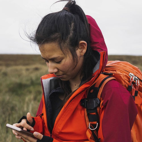
Unlocking the Power of Location in Travel and Tourism with Traveltech for Scotland
As the number of IoT enabled devices we use increases, such as wearables, voice-activated tech, or connected devices for our cars, the volume of location data is only set to increase. CGI UK estimates that the location data market is growing by around 15-20% per year and that the “power of where” can help deliver better business and government outcomes*.
Location data, when used creatively and responsibly, can impact on our lives, our communities and our businesses. It can help us get around, on foot, by car, or by bike; check traffic, travel services and weather conditions; it can tell us more about why and when people are in spaces and how often they are using services. It can help improve and enhance services in communities and can make a real difference to people’s lives.
At Traveltech for Scotland we’re seeing businesses in our traveltech community use location data in innovative ways to solve problems, improve services, enhance skills, connect up elements of visitor journeys, and enhance and personalise the visitor experience. Our Traveltech Directory is where you’ll find many of them, and more are emerging all the time.
Traveltech for Scotland has partnered with Location Data Scotland to run a joint event on Thursday 27th May to explore the potential of location data for travel and tourism. If you are a tourism, travel or technology business looking to explore the opportunities in location data, please register for the webinar here.
When it comes to improving and enhancing customer service, cloud-based Neatebox WelcoMe smartphone app is a perfect example. This award-winning app is helping to improve the lives of disabled people through its technology, and significantly improving communication between customer-facing staff and people with disabilities in venues such as banks, shopping centres, visitor attractions and passenger ferries, hotels and airports. The smartphone app’s location technology triggers a notification to a nearby participating venue which is informed about how to best serve an approaching disabled customer before they arrive. The app also provides accessibility training and tips to staff on how best to support disabled visitors and customers, a game-changer for both the visitor and the venue.
With Covid-19 impacting significantly on leisure and work patterns, the majority of us have been spending more time outdoors in all weathers, cycling, walking, and even outdoor swimming. We’ve been rediscovering our local parks, beaches and places on our doorsteps, not entirely without challenges for those managing and protecting our natural environments. By collaborating with Interface, Censis and visitor management groups across Scotland to explore the uses of IoT and sensors, together we’re learning how location data can help us better understand visitor movement and flow in our national parks, beaches, towns and cities, as well as helping organisations to address visitor management challenges and ways to influence visitor behaviour.
A greater appreciation for the outdoors and for Scotland’s natural assets is inspiring the design of new routes and trails, bringing together the routes we want to take, the trails we want to explore into easier, more accessible formats. Start-up Walks & Waterfalls is developing an app to allow users to locate hundreds of walks, waterfalls and wild swimming places in Scotland. The app uses OS mapping and Geolocation allowing users to ‘bag’ waterfalls with live digital leader boards and social engagement. Walks and Waterfalls, included in the Geovation Scotland Accelerator programme, is one to watch.
Very often, innovation occurs when the product or service that we want as a solution doesn’t exist, so we end up creating our own. The founders of Huli, keen adventure cyclists, spotted a gap in the market when they couldn’t find a tool to help them map out a route to explore the French Alps. The founders’ experience in satellite research allowed them to develop an application which enables cyclists to create their own routes. Huli automatically creates personalised routes wherever people are just by clicking on their smartphones.
As the need to reduce our carbon footprint intensifies and the demand for electric vehicles grows, so too does the need for EV charging points, and travellers want to manage and curate their own touring routes. This demand is shaping the needs for new products and services, and early stage start-up Electrek Explorer aims to simplify trip planning for electric vehicles so that travellers don’t have to worry about locating charge points, hotels or activities. The Electrek mobile app aims to hold all the information travellers need in one place, removing worries about range anxiety, and offering a range of services to enhance EV road trips.
Whether cycling or photography, walks or waterfalls, shared leisure and travel interests are inspiring and informing communities, and we’re finding new ways of sharing tips and recommendations through location data. The What3Words app, which gives every 3m x 3m square a unique combination of three words (bought.sugar.defend for the Scott Monument in Edinburgh, for example) has traditionally been used to help speed up responses by the emergency services to assist people. Currently all of Scotland’s emergency services use What3Words. However, now, walkers and hikers are using the app to share locations of recommended routes, photographers are sharing the location of great shots, travellers and bloggers using the app to share favourite places with their followers. Destination organisations are including What3Words references on digital maps to mark popular local beauty spots and finding an uptake in user searches for walking and cycling routes as a result.
More of our pioneering traveltech businesses, including Pour, an innovative food and drink ordering app for independent bars and restaurants, are developing the use of location data to enable client venues to maximise data use for business decision-making. From insights shared at the recent Scottish Tourism Alliance Spring Conference we’ve learned that more tourism operators are using location data to manage the movement of visitors, as well as enhancing visitor experience: the city of Venice and Disney Parks and Experiences just two examples.
The launch of Location Data Scotland has introduced us to several organisations working in this space, offering huge potential for the travel and tourism industry to develop innovative products and services to benefit visitors, residents and communities. We look forward to collaborating with this community and to understanding how together, we can unlock the power of location.
Join us on Thursday 27th May online to explore the potential for location data in travel and tourism.
Location Data Scotland launch event – unlocking opportunities in location data
We heard from both government and industry experts on the opportunity this exciting sector offers and how organisations can get involved.
Ashley Stewart from Optimat, the cluster builder partner leading on the Location Data Scotland network, opened the event and provided an update on the progress within the project to-date. Optimat were appointed to deliver the project by Scottish Enterprise, who manage the project on behalf of the contributing partners namely Scottish Enterprise, Scottish Government and the UK Geospatial Commission.
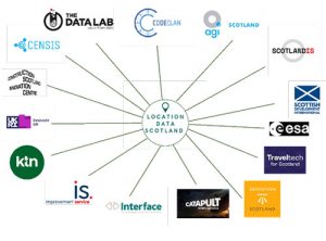
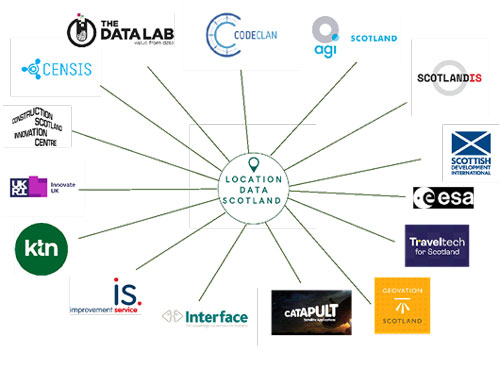
Having engaged with 80+ organisations, developed an online community on LinkedIn of 250 individuals and recently finalised the members of the steering group, Location Data Scotland is already playing a key role in developing a robust geospatial community in Scotland. Building a network of partners has been high on the list for Location Data Scotland and there has been fantastic appetite to get involved so far with organisations and programmes such as TravelTech for Scotland, the Data Lab, CodeClan and more recently a partnership with Aerospace Valley in France.
Location Data Scotland Network Partners

Next we heard from both Scottish Government and the Geospatial Commission about their involvement as project sponsors within the programme and the activities they are currently engaged with.
Alan Corbett, who heads up the GSAT team at Scottish Government provided an overview of Scotland’s forthcoming geospatial strategy.
“Having access to accurate location data is proving invaluable in the Scottish Government’s fight against COVID-19, highlighting how location data can help save time, money and lives.
Scotland has a thriving and innovative geospatial business opportunity. Our strategy focuses on driving further investment in our world-leading tech industries, which are providing high value, skilled jobs and have an important role to play in Scotland’s sustainable economic recovery.”
Abigail Page, Head of Innovation and Skills at the Geospatial Commission, spoke about the innovative uses of geospatial in business. “The UK has an abundance of data, new technologies and growing consumer interest in how that data is used. There is a real opportunity for location data – from new ways of capturing data and using it.”
The UK Geospatial Strategy was launched in June 2020 and identified nine location data opportunities including infrastructure, transport, housing, environment, public health, emergency response, ocean economy, retail and finance. In supporting Location Data Scotland, the Geospatial Commission wants to learn from the best innovators in Scotland as to how they are deploying geospatial technologies and use this opportunity to further unlock the value in location data.
We also heard from the Association for Geographic Information (AGI) the UK’s professional membership body for the geospatial industry. The AGI supports a thriving community, providing thought leadership and supporting career and skills development. The national group, AGI Scotland, enthusiastically welcomes and supports the Location Data Scotland initiative and looks forward to working in partnership to support , support the ambitious plans. ScotlandIS who head up the data cluster in Scotland also noted its delight to be working in partnership with Location Data Scotland to build the geospatial community, create connections and enable collaborations across the work that they do.
Alan Moore, AGI Scotland Director and CEO of thinkWhere commented following the event, “Location data is the golden thread that links people, places and processes and can unlock value in almost any industry or business sector. By taking a cross-industry approach and building geospatial awareness and connections across the different communities of interest across Scotland, Location Data Scotland will yield many new opportunities for innovation and digital transformation. Collaborating with AGI Scotland and other key stakeholders in the digital technology and data landscape will be a key cornerstone in realising the value-added potential of location data.”
If you missed our launch event you can watch the recording on our Events page or on our YouTube channel.
There are lots of opportunities for Location Data Scotland to engage across industries and sectors and the next few months will see the programme delve deeper into key sectors to unlock the value in location data.
Ensure your organisation joins us on this journey by joining our LinkedIn Group, follow us on Twitter @location_data or get in touch to see how we can help you capitalise on this huge opportunity.
Developing a strong community to unlock the value of location data
Location data and insights are of immense value to the UK economy, transforming our cities, connecting communities and boosting our businesses. It affects all aspects of our lives from real-time travel updates and local weather reports to fuelling location-based search engines.
Location Data Scotland (LDS) has been developed in partnership with Scottish Enterprise, the Scottish Government and the UK Government Geospatial Commission and is managed by Optimat Ltd. It has been established to connect, inform and facilitate collaboration across multiple organisations and sectors to drive innovation, unlock skills and enable economic growth.
Location Data Scotland will help organisations across many sectors: tourism, construction, transport, built environment, energy, space, agriculture, food and drink, utilities, telecommunications and many more to understand the potential benefits and gain access to the insights that can be gained from location data. These organisations will have access to, and information on, funding opportunities and information on economic development opportunities, with insights from the project helping influence government policy.
Location Data Scotland already has a community of over 170 organisations working on location-based data and services who have joined the LDS LinkedIn group. Work has also started on raising awareness of the active Scottish geospatial sector to other economic sectors, including highlighting how location-based data can benefit, for example, tourism, space, agriculture and more. The network has also signposted the community to support including, for example, European project opportunities, events and facilitating introductions to encourage collaboration between organisations who can help develop geospatial technologies and share lessons learned.
![]() Mark Wilkinson, Head of Business Development at The Data Lab said, “It is fantastic to see Location Data Scotland focused on growing Scotland’s geospatial sector. There’s huge potential to develop a robust community focused on creating innovative products and services, unlocking the value of location data. We are delighted to be working in partnership with Location Data Scotland to explore a range of exciting joint opportunities.”
Mark Wilkinson, Head of Business Development at The Data Lab said, “It is fantastic to see Location Data Scotland focused on growing Scotland’s geospatial sector. There’s huge potential to develop a robust community focused on creating innovative products and services, unlocking the value of location data. We are delighted to be working in partnership with Location Data Scotland to explore a range of exciting joint opportunities.”
 Alan Corbett, GIS Analyst at Scottish Government said, “Scotland has an active and innovative geospatial sector and Location Data Scotland is a wonderful opportunity for the sector to grow and thrive. The use of accurate location data has proven invaluable in the Scottish Government’s fight against Coronavirus (COVID-19) exemplifying how the use of location data can help us to achieve our vision that data is used to save time, money and lives.
By promoting entrepreneurship in the sector and collaboration with those who will benefit from adopting these technologies Location Data Scotland will help to bring the benefits of location based data to our citizens and businesses creating economic, social and environmental value. The development of this cluster will help to drive innovation and promote investment in the sector.”
A launch webinar has been planned for 23 March 2021 for company directors, business leaders, stakeholders and partners to hear about the ambitious plans around the project. Featuring experts from across the sector, the event will explore how the LDS community can help to connect, inform and facilitate collaboration between industry, academia, public and third sector, across multiple organisations, to drive innovation, unlock skills and enable economic growth. If you wish to get involved and find out more, register for this event here.
The LinkedIn group is open to anyone working in location data or data services. Join the Location Data Scotland community here.

